Miscellaneous April 22, 2016April 22, 2016alexNo Comments wordpress Usa Selector (Miscellaneous) Live PreviewPurchase 19.00 Read More
Utilities May 2, 2014May 2, 2014alexNo Comments WordPress GeoIP + Cities Plugin (Utilities) Live PreviewPurchase 16.00 Read More
Utilities April 16, 2014alexNo Comments WordPress GeoIP Plugin (Utilities) Live PreviewPurchase 14.00 Read More
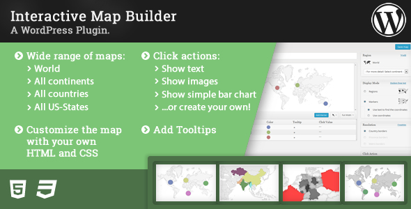
Utilities March 25, 2014March 25, 2014alexNo Comments Interactive Map Builder (Utilities) Live PreviewPurchase 18.00 Read More
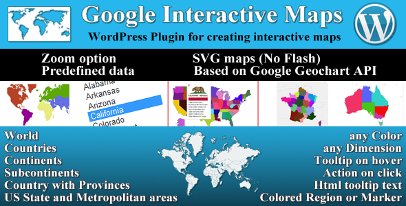
Utilities March 14, 2014March 14, 2014alexNo Comments Google Interactive Maps (Utilities) Live PreviewPurchase 18.00 Read More